
Tracing a Newburgh Street
A Newburgh street search is a sequence of separate record checks. The City Assessor’s roll or PROS portal gives a property lead. Orange County GIS places the parcel on the correct municipal map. The deed index identifies recorded parties and transfers. A targeted city request may locate permit or code material that is not available in a public search. Finally, post-1918 directory street sections can offer historical household clues. Each source has a different time span and access channel.
Start with a complete street address, but do not discard the unit, directional word, suffix, postal ZIP, or former-address text. The county’s map layer can help locate a parcel even when a record spells the street differently. If a result has a City of Newburgh mailing label, verify that the parcel and municipal layer are actually within the city before treating it as a city record.
- Find the address in the City Assessor source and record the roll year, situs, owner, mailing address, parcel or print key, and deed book/page.
- Open the county GIS, select the same parcel, and record the layer name, PIN, geometry, and map date.
- Use the deed book/page or party name in the Orange County IQS index, then read the recorded instrument rather than relying on the roll.
- For a past household, use the post-1918 address section in a local directory and verify a listed name in the alphabetical section.
- When online sources stop, ask the appropriate city or county custodian for the specific file, book, page, or date range.
Note: A Newburgh street directory trail should identify a role and record date, not make a blanket claim that every listed name lives there.
Newburgh City Parcel Searches
The City of Newburgh Assessor maintains the city assessment roll and links to the PROS assessment portal. The office reports more than 6,900 properties. The city source is important because Orange County’s public Image Mate notice says its weekly assessment feed excludes current City of Newburgh assessment records. Use the county material as a dated or mapping resource where appropriate, but do not describe it as the current city assessment source.
An assessment result can show an owner-of-record, mailing address, situs address, property class, value, exemptions, former-address text, and deed book/page. Those are assessment fields. A roll row does not prove who occupies a home, and a mailing address may be a PO Box or another location. The parcel reference is most useful as a bridge to the map and a recorded deed.
The City Assessor page is the official starting point for the Newburgh street directory property route.
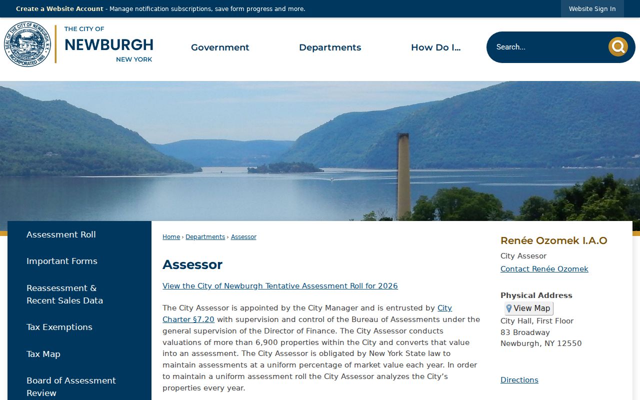
The assessor link helps keep a Newburgh address search tied to city assessment data rather than the excluded county current-data feed.
The PROS assessment interface is the live city portal behind that address-led search.
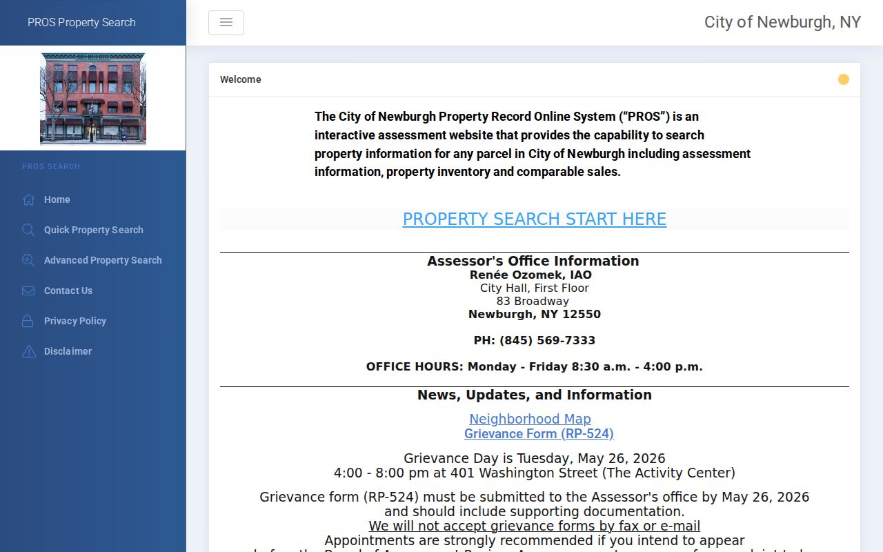
The portal view reinforces that current property clues should be checked with their roll date and followed to the recorded deed when title detail matters.
| City assessment field | Street-directory use | Limit |
|---|---|---|
| Situs address and parcel | Matches the property to GIS | Not a legal survey |
| Owner and mailing address | Identifies assessment roles | Not proof of residence |
| Former-address text | Lead for older maps and directories | Not a documented renumbering date |
| Deed book/page | Lead to the recorded instrument | Read the deed for details |
Newburgh GIS Street Layers
The Orange County GIS Map Viewer is the street-by-street spatial index. Its Newburgh City parcel layer and municipal parcel layer expose address, owner-name fields, PIN or print key, property class, school district, city, state, ZIP, unit, and geometry. Search help says owner, address, parcel, municipality, and partial-string methods are available. The live control labels may change, so save the map date and layer name with the result.
Use the viewer to zoom to a street segment, click the target polygon, and compare touching or nearby parcels. Geometry can show which parcels contact on the map. It cannot establish title, a legal boundary, or an occupant list. Corner lots and through parcels need special care because a familiar address may face one street while its parcel edge touches another.
The county GIS help image shows the search behavior used for a Newburgh street directory query.
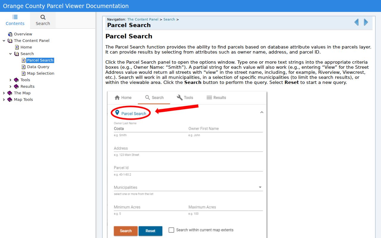
Use the documented owner, address, parcel, and municipality options to locate a street segment before moving to a deed or city file.
Newburgh Address-Keyed Records
Address records in Newburgh form a chain, not a single street directory. The assessor owns the current city assessment point. GIS provides geometry and mapped attributes. IQS and the County Clerk supply recorded instruments. Building and code files may document an event at an address, but no public city permit or violation search was located. Voter lookup is identity based and does not permit unrestricted browsing of everyone on a street. Local directories carry the historical household layer.
| Address record | What it links | Access channel | Boundary |
|---|---|---|---|
| City PROS and dated roll | Owner, mailing/situs, class, deed lead | Portal and city roll | Assessment, not occupancy |
| County GIS | PIN, address, map geometry | Public map viewer | Not title proof |
| IQS deed index | Grantor, grantee, instrument | Login, Record Room, copy request | Coverage and image limits |
| Building or code file | Permit, inspection, violation events | Targeted city FOIL request | No public case portal located |
| Directory street section | Historical listed households | Library and Society reference | Street search from 1918 |
The parcel or PIN makes the map-to-roll match more reliable. The street string helps with directory and building-file requests. A deed’s legal description may differ from the postal address, so retain both. The previous residents search uses this same chain to move backward through one address over time.
Newburgh Deed and Map Chains
Orange County’s online records route directs users to IQS. The land-record index covers December 31, 1953 to the present, with historical grantor-grantee books for 1910 through 1977 and category-specific back-scanning. Search by party, date range, document group or description, town, book/page, instrument number, or case number. Fewer filters broaden the search, and not every record is indexed to a town.
For a Newburgh street directory trail, use the current deed’s grantor and grantee to locate the prior transfer. When online coverage ends or an image is restricted, shift to the County Clerk Record Room, the historical grantor-grantee books, and the county historical materials. County history identifies deed books A through 450 from 1703 through 1900 and mortgage books A through 71 from 1703 through 1869. A certified copy requires the County Clerk’s copy-request route, payment, and a self-addressed stamped envelope.
Filed maps offer another bridge. County history says maps begin in 1768. A map can explain a subdivision, lot, or former number, but should be read with the legal description and current GIS geometry. The Library of Congress 1913 Newburgh Sanborn set has 69 sheets and can show building footprint or use. It is not a resident list.
- Grantor
- The party conveying an interest in a recorded deed.
- Grantee
- The party receiving that interest.
- Legal description
- The lot, block, subdivision, or metes-and-bounds description that controls the conveyance.
- Plat or filed map
- A recorded map that can help relate lots and street layout.
Newburgh Property File Requests
Newburgh Building and Code Enforcement handles construction, property code, plumbing, street openings, permits, inspections, violations, and related public records. The Bureau is at 123 Grand Street. The research did not locate a public, address-searchable city permit or inspection database. The useful fallback is a targeted request through the City Clerk and the Newburgh FOIL page.
Describe the property files by address, parcel if known, specific record type, and a time range. A request for permit applications, inspections, violations, certificates, fire or renovation records, and correspondence for a defined period is more workable than a request for every record connected with an address. Under New York FOIL, agencies generally acknowledge written requests within five business days and provide a reasonable date or explanation for longer processing.
Building files can document a fire, renovation, inspection, or permit event. The Historical Society cautions that they do not supply building plans. Do not turn a permit applicant or owner field into an occupancy claim.
Newburgh Street Directory History
Newburgh’s local directory collections give a street search its historical layer. The Historical Society reports that volumes before 1918 are surname-alphabetical and do not have an address cross-index. From 1918, both street-address and surname searching are possible. Find the known address in the street section, copy each printed name and role, check the alphabetical section, then compare the next directory edition. A telephone book can extend a lead later than a city directory, but a subscriber is not necessarily every household member.
The Newburgh Free Library and the Historical Society are the main local shelves. The library reports city directories from the 1860s and telephone directories from the 1930s into the early 2000s. The State Library catalog adds several fiche and film runs. Historical names, occupations, marital-status notations, and legal-age household residents need to be copied as printed, then paired with a deed, roll, census, obituary, or probate record. The Newburgh directory book describes the collection path without rebuilding the current address workflow.
Newburgh Address Geography
A postal ZIP is not a municipal boundary. Official city-roll examples show both 12550 and 12551, while 12552 is an associated Newburgh postal label. The research did not locate a definitive city ZIP polygon, ZIP split date, or citywide address-renumbering project. USPS warns that delivery boundaries can change. Keep ZIP as an observed postal field and use the parcel, municipal layer, and city or town custodian to answer a jurisdiction question.
Street continuity also requires the original number, prefix, suffix, unit, former-address notation, and legal description. If two Newburgh records disagree, retain both strings and the evidence that might connect them. Do not invent a renumbering year or call two similar postal addresses the same parcel without the supporting map, roll, or deed.
Limits of Newburgh Street Searches
A public Newburgh street directory cannot reveal every household member, private renter, utility customer, delivery recipient, protected voter, confidential-program participant, or DMV address. The public voter tool is identity based, and election-data requests have stated purpose limits. GIS polygon contact does not make a parcel a residence list. Assessment owner and mailing fields can point to a record, but they do not establish who lives in a dwelling.
New York’s Address Confidentiality Program and confidential voter registration protect eligible people. Court portals also omit sealed and confidential matters. Public records should be used for a specific, lawful research purpose such as family history, an estate trail, property history, or civic verification. Preserve record role and source date rather than adding an unverified explanation.
Newburgh Street Trail Notes
Keep a small worksheet for each Newburgh street directory search: the exact address string, municipality, ZIP, parcel or PIN, roll year, map layer, search date, source URL, and the role printed beside every name. Add the deed book/page, directory edition, or request acknowledgment when one exists. If a source returns no result, record its coverage and access limit rather than treating the silence as proof of absence.
This record trail is useful when a library reference worker, clerk, or archive asks for more detail. It also prevents a City of Newburgh result from being silently merged with a Town of Newburgh record. Careful labels make an address search more accurate without stretching property and historical records beyond what they show.